Win more projects by partnering with us.
Topos in 48 hours. 0.1' accuracy. CAD-ready deliverables.
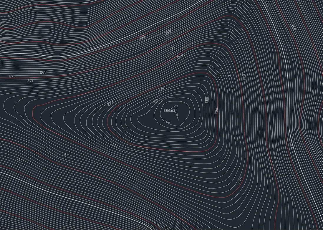
Topographs
Topographic surveys showing 3D surfaces with contours, spot elevations, and breaklines.
- 48-hour delivery from flight to CAD (up to 500 acres)
- 0.1' accuracy with documented accuracy report
- 3D topographic surface, contours, breaklines
- CAD-ready planimetric features and point cloud
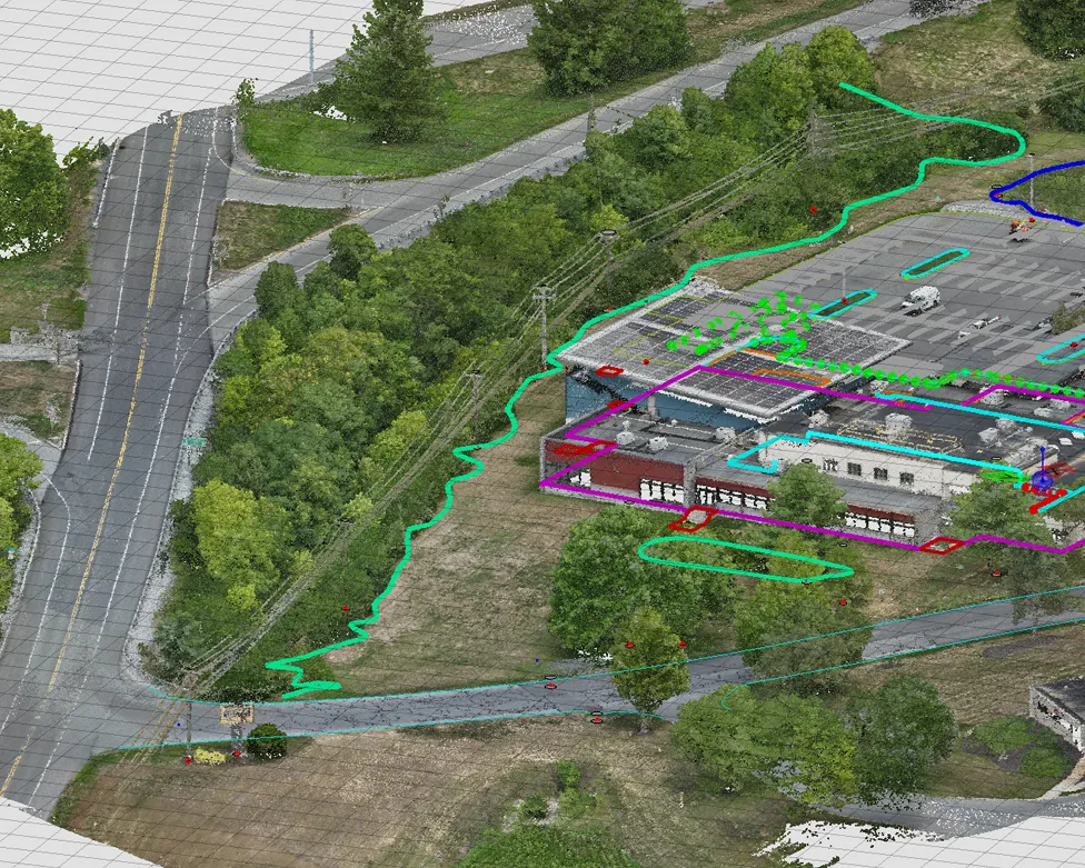
Point Features
Automated extraction from LiDAR point clouds to identify site features.
- 40+ feature types: curbs, inlets, paint lines, light poles, manholes
- All linework delivered in 3D
- Suitable for municipal and site development projects
- High-precision extraction from LiDAR point clouds
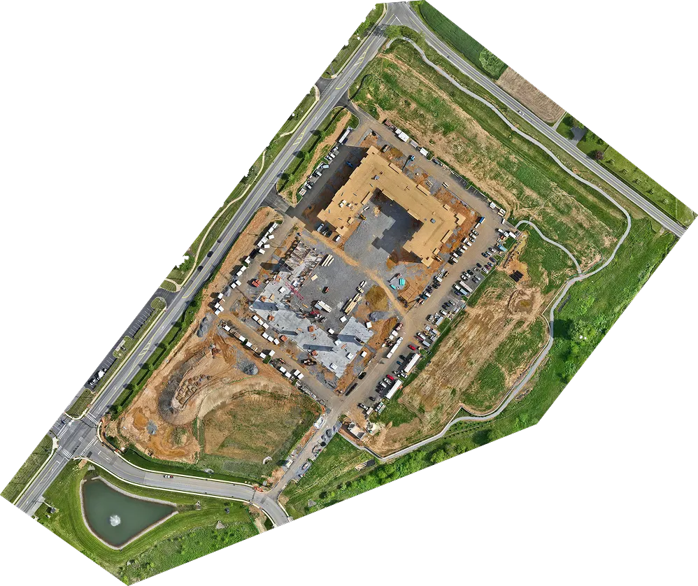
Orthomosaics
Georeferenced composite of overlapping drone photos.
- GeoTIFF format with embedded georeferencing
- Up to 1.0cm GSD
- Distortion-free, map-ready imagery
- CAD and GIS compatible